A new study by Dr. Zef Segal highlights how maps from the late nineteenth to mid-twentieth century were used to promote antisemitic ideas. These maps, which depicted Jewish migration, often portrayed the movement as a threat, using visual language that likened it to a spreading plague. The research shows that such maps were not limited to Germany, but also appeared in the United Kingdom, reflecting widespread prejudices of the era. Dr. Segal emphasizes that maps are powerful tools that can shape public perception by simplifying and distorting reality.
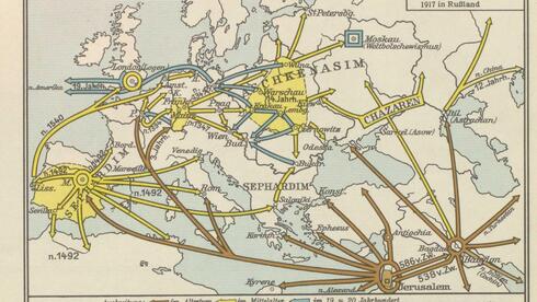 image sourced from original article at https://www.ynetnews.com/jewish-world/article/rjnicvwdel
Original article source: https://www.ynetnews.com/jewish-world/article/rjnicvwdel
Source Id: 8797585603